The night of March 29, 1954, was long and terrifying for the people of Baghdad. Though the flood no longer directly threatened them from the river, the city’s inhabitants remained at risk from the eastern side, as new fractures in the rivers north of Baghdad had opened and were already placing severe pressure on the city’s surrounding areas, exacerbated by the strong winds that had continued to rage for two straight days. Due to the seriousness of the situation, the British engineering team that was hired by the Directorate of Irrigation General informed the government that three-quarters of a million people in the city were at risk.
Emergency meeting and a courageous minister
Such a circumstance demanded an emergency meeting, which was called at the General Directorate of Irrigation and attended by all the relevant official centers of the country, including ministers, members of Parliament, a large number of experts and the Crown Prince Abdullah bin Ali. Participants agreed on a statement and decided to evacuate and relocate residents from the densely populated Rusafa side of Baghdad to the Karkh side of city.
One attendee, the late Minister of Interior Mohammed Saeed Qazzaz, opposed the decision and put forward a different opinion, one for which he would bear full responsibility for after having assessed the risks that the evacuation would cause and concluding that these would outweigh the risks of residents staying in their homes. He argued that the breakdown of one car on one of the two bridges in Baghdad during the evacuation would lead to large-scale deaths among the terrified masses of people fleeing their homes and to an unprecedented disaster for the country. Attendees concurred, and Qazzaz announced this policy to the people of Baghdad on government radio.
The birth of the dam
As the wind calmed down and the river levels receded, Baghdad escaped the danger, but the crisis prompted the Iraqi government to establish a new system for controlling the country’s water resources and to entrust the implementation of the new plans for this system to the Council of Reconstruction, including the construction of the Darbandikhan Dam, which would control high water levels from the Sirwan River that had threatened Baghdad and had caused previous floods.
The council undertook a comprehensive survey of the riverbed and assessed studies of the areas proposed for the dam. All possible methods of construction were considered based on cost and how much water could be stored, with major international companies from the United States and Europe providing feasibility studies with such estimates.
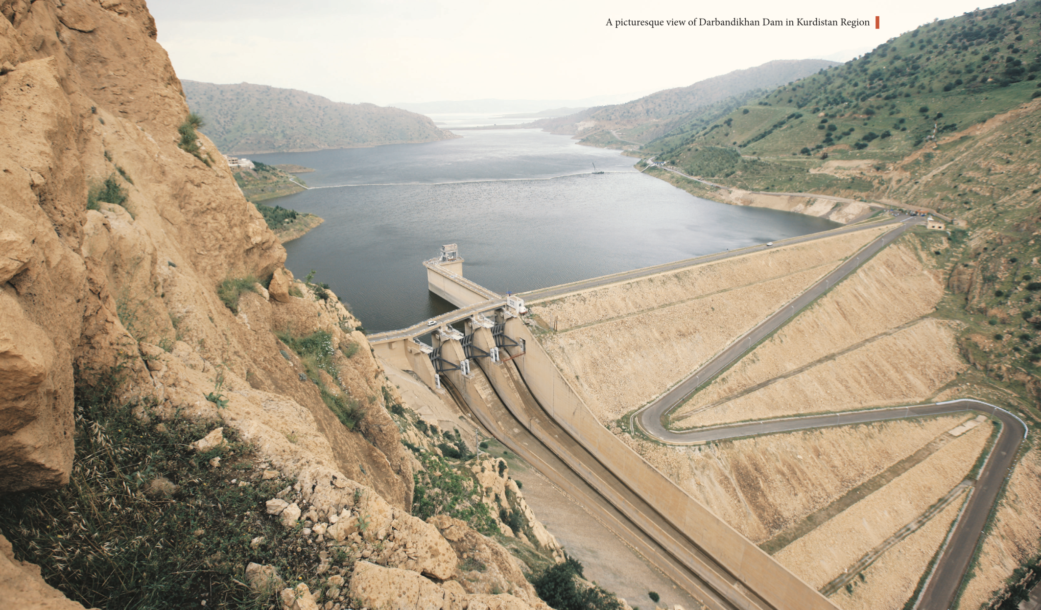
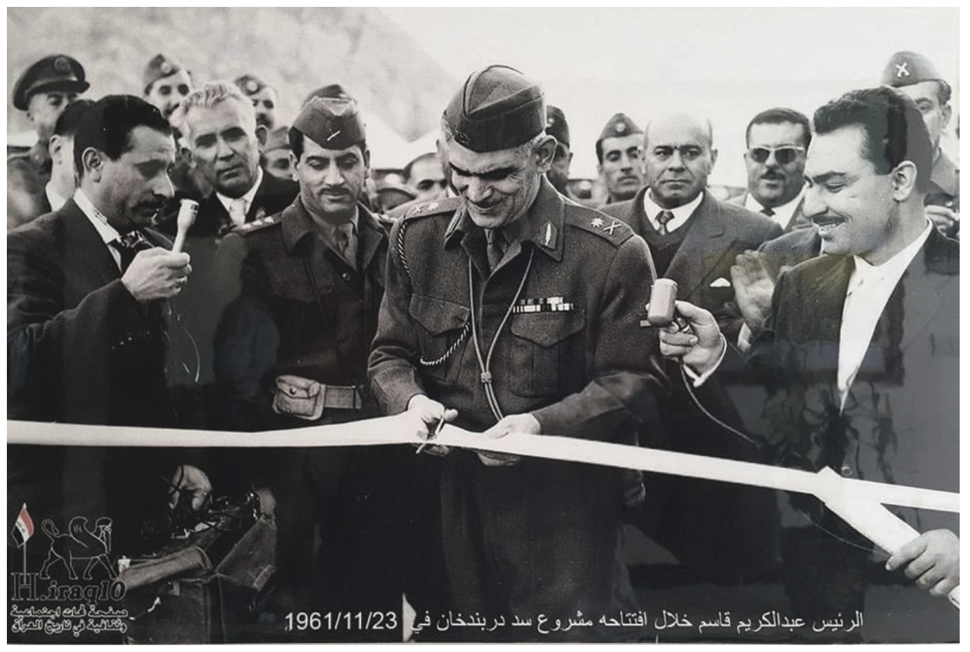
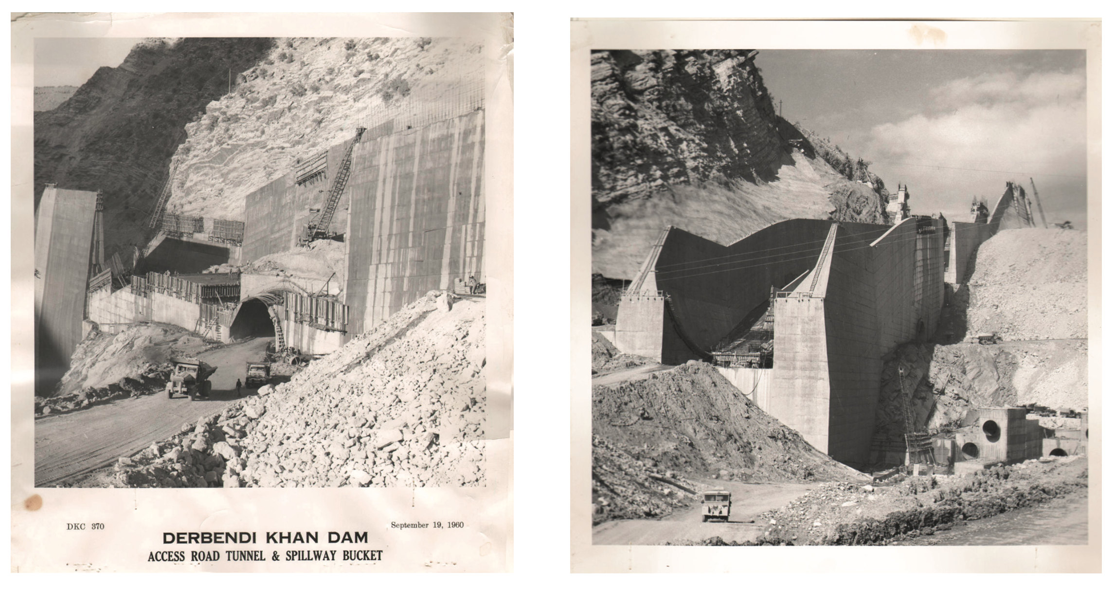
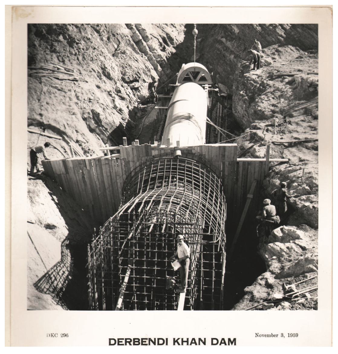
By 1956, all the preparations had been made to begin construction on the river close to the Darbandikhan district in the Sulaymaniyah governorate. The work was then carried out by American companies over five years, so that Prime Minister Abdul Karim Qassim inaugurated the dam on November 23, 1961, in time for the wet season that year. Since the storage capacity of 2.5 billion cubic meters was insufficient to absorb greater rises in water levels from the Sirwan River, the dam became the main part of a storage, operation and irrigation system that would be completed with the later construction of the Hamrin Dam and Al-Sudour Dam in Diyala.
A design ahead of its time
Of course, much has changed in the design, methods, and technologies of dam construction and operation since the 1950s. Though the dam at the time was cutting edge, it now requires a wholescale review to consider how to implement the latest monitoring and sensor technologies and to take advantage of digital computing systems. This process can help nurture a new generation of engineering and technical specialists who can develop their skills in managing dams and water systems in line with the expansion of scientific understanding.
When the dam was first constructed, two proposals were submitted: one for a concrete dam similar to the Dukan Dam, and one for a dam made of stone with a clay core. Based on the feasibility studies presented, the collective opinion of the technicians settled on the second proposal of a clay core. The texture of the core was determined with specifications that would suit the conditions surrounding the dam and the possible environmental changes that might occur, especially since the dam would be located very close to the active seismic belt in the western Iran. The dam’s length was less than 450 meters, which was ideal in terms of cost and functionality. There was no need for post-construction filling work, and nearby quarries provided abundant supplies of the necessary materials. The dam's water column height was over 100 meters, an ideal design for the three-unit hydroelectric power plant with a total capacity of 250 MW that accompanied the dam.
Earthquakes and war
In November 2017, as the 56th anniversary of the dam’s opening was approaching, it was subjected to a violent earthquake measuring 7.2 degrees on the Richter scale, with its epicenter approximately 100 km from the dam’s axis. In the preliminary study, the dam’s designer expected that it would be exposed to an earthquake of this magnitude, although the probability of such an event was roughly 1 in 1,000. Yet the design was accepted on this basis, and the dam indeed withstood the earthquake’s tremors and did not incur serious damage, as the tremors occurred where storage levels were under the maximum limits. Therefore, the rehabilitation process was short, and the dam returned to operation that very same wet season of 2017-2018. The following wet season of 2018-2019 proved another test for the dam, as storage levels approached the maximum limits, but there were not any problems.
It is worth noting that the Darbandikhan Dam previously experienced a different type of earthquake in the 1980s, when it was the site of clashes during the Iran-Iraq War. During this time, the former Iraqi regime destroyed and removed the dam’s floodgates for military reasons, knocking the dam out of service and preventing the accumulation of water. The dam was rehabilitated after the war’s conclusion and thus stands as a living memory and true witness to the conditions of water, people, and nature in Iraq.
Breathtaking beauty
The dam is in one of the most beautiful parts of Kurdistan, and its lake extends between high mountains and winding valleys, leaving small islands between them. When the waters recede, it leaves flat lands between them and creates a lake that has moderate temperature during most seasons of the year. Although the dam itself is a tourist attraction, its location and the region’s topography constitute an ideal environment for tourism investment.
Further clarification
In the spring of 1954, Baghdad experienced an unprecedented rise in the level of the Tigris River due to a wave of surging waters in the lower Zab and Sirwan basins due to a rush of melting snow and rain.
Muhammad Saeed Qazzaz, a Kurdish citizen born in Sulaymaniyah, held several positions during this period, including as Minister of the Interior in multiple governments. After the monarchy system ended, he was tried in court and sentenced to death after refusing to concede and there he said his famous words: “I stand close to death and am not intimidated by the ropes of the gallows; when I am hung, I will see many who do not deserve to live under my feet.”
Clay core and pulp: these were clay materials that were placed in the heart of the dam to prevent water leakage.
The wet season is the rainy season in Kurdistan, from the beginning of October to the end of May.
Kadhim Sahar was the coordinator of the General Directorate of Dams between Iraq and the Kurdistan Region. He is an accomplished authority for 34 years in the field of dam creation and management in Iraq.

