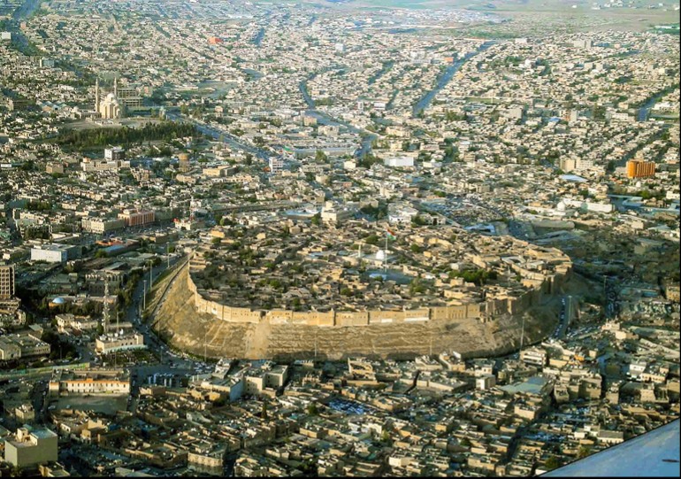
It is unfortunate that the word “Kurdistan” as a designation of a homeland for the Kurdish nation provokes such controversy and tension among chauvinists who have been denying the existence of a geographical area of land with this name and claiming that a homeland in the name of Kurdistan has only recently appeared, despite the overwhelming historical evidence of the name’s veracity.
As if the great poet Malaye Jaziri (1570 – 1640) mentioning the name of Kurdistan at the beginning of the 17th century is not enough. Nor is the appearance of this name in ancient historical sources written by non-Kurds, such as the book Jami’ Al-tawarikh (History\Date Collector) by Rashid Al-Din Fadl-Allah Al-Hamdani in 1310 AD, followed by the historian Hamdallah Mustafi Qazwini’s famous book Kitab Nuzhat Al-Qulub (The Picnic of Hearts) in 1339.
But what also interests us here is that the name of the Kurds’ homeland has appeared in ancient geographical maps of different varieties.
Maps of an earlier world
The use of maps dates to ancient times in Mesopotamia. They were first used by the ancient Egyptians, Greeks, and Chinese and later, with the spread of Islam, Arab-Islamic maps appeared and filled the need of Arabs desiring to know about the lands they should move to, conquer, or liberate, as well as the borders of their new countries. Al-Idrisi (1100-1166) was the first to draw cartography, who was then followed by geographers or so-called Bulldans. In these sources, the country of the Kurds was called “the region of the mountains or the mountain” because of the predominance of the rugged mountainous nature of the land of Kurdistan.
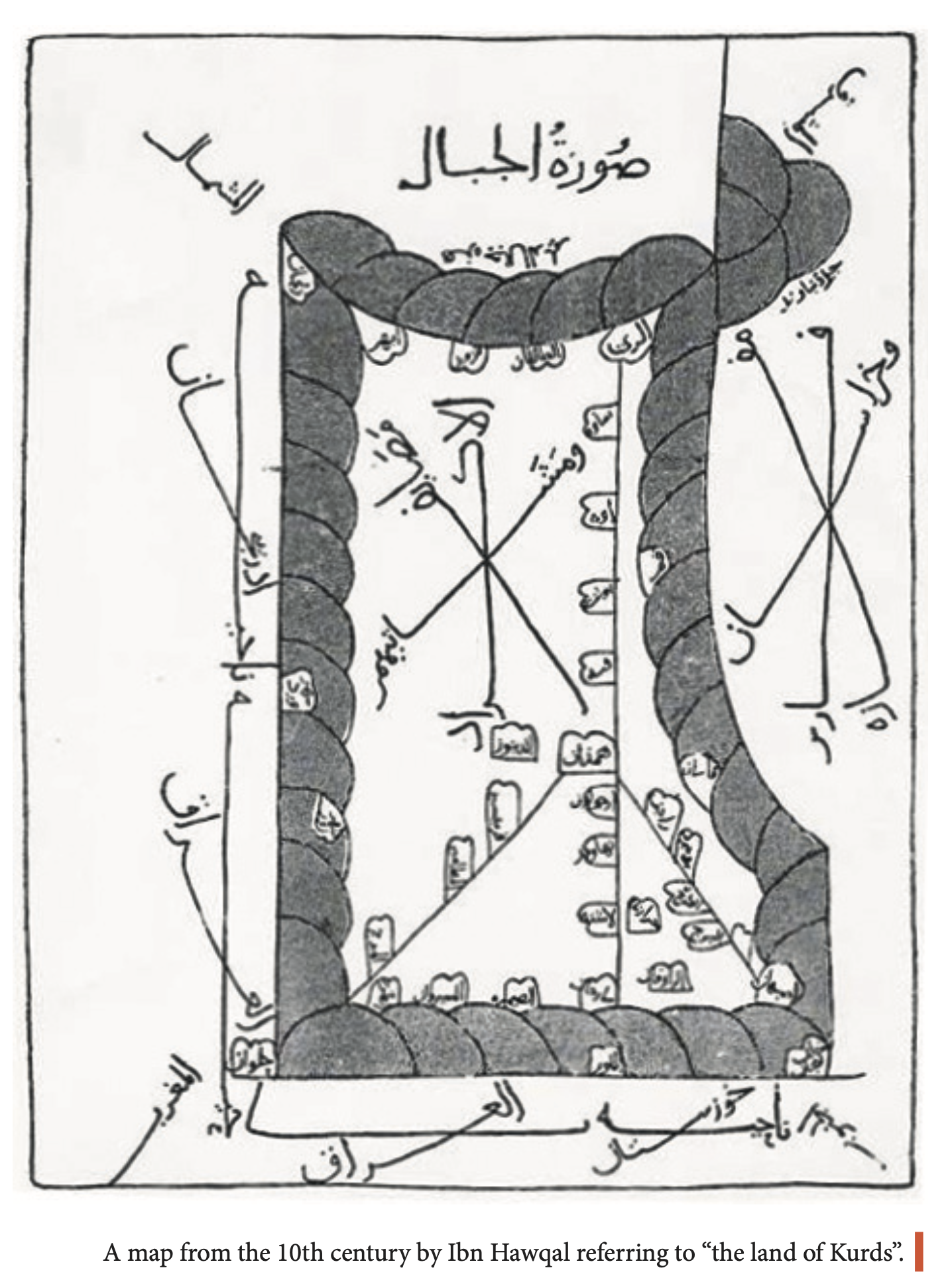
One ancient cartographer who referred to the land of Kurdistan was Ibn Hawqal (died 977 AD), author of the famous Sourat Al-Ardh (The Earth Image). In this valuable book, he published a set of maps that he had drawn himself of the known geographies of his time, wherein all of them refer to Kurdistan as the mountains. In one, he drew a special map of Kurdish areas calling them “Kurdish Resorts, Summer Cottages and Their Groves.”
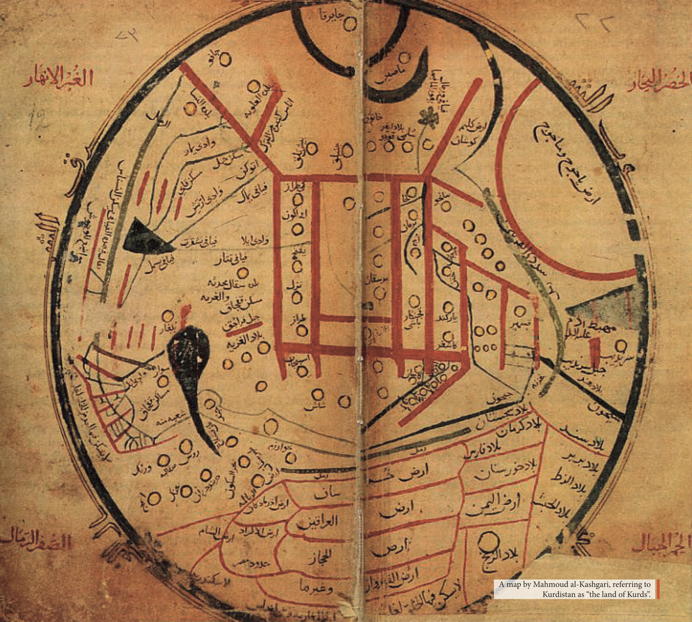
After this, the famous historian, geographer, and linguist Mahmud Al-Kashgari (1008-1102), who wrote the book Diwan of Turk Languages, published a map in which he referred to Kurdistan as the land of the Kurds and detailed that its borders met with Iraq, Khorasan, Azerbaijan, the Levant, and Egypt. Undoubtedly, the phrase “The Land of the Kurds” is a literal translation of the word Kurdistan, as the word ‘stan’ or ‘istan’ means a ‘country’ or ‘land’ in Persian.
It is also worth noting that the Turkish nationalist author Al-Kashgari, not a hateful racist in fact, attempted to use the guise of scholarly research to advance his views. If this great Turkish author had been as racist as is the case now among some scholars, he would have ignored the reference to a land called The Land of the Kurds altogether. But he did not draw that from the roots and springs of chauvinism that shaped the minds of the ideologues among the Young Turks, the Committee of Union and Progress, or the Baath Party; instead, he wrote it with the conscience of a scientific researcher who puts historical truth at the forefront of his priorities.
But as far as I know, the name of Kurdistan did not appear in the form of this word in any of the maps drawn by the Arab and Muslim Bulldans such as Al-Idrisi, Al-Maqdisi, Ibn Hawqal, and others. Rather, the European travelers were the first, and they referred to the country of the Kurds by the current name, Kurdistan.
Enter the Europeans
In a map drawn in 1596 by the Dutch traveler, merchant, and explorer Jan Huygen van Linschoten, there is an area marked Curdi beneath Armenia extending to the west of Lake Van that, I believe, is meant to be the Land of the Kurds. This is one of the oldest maps on which the name of Kurdistan appears. Many of the maps preceding this and even some following it write the land of the Kurds between the Tigris and Euphrates rivers as Mesopotamia, a well-known historical name that means ‘country between the two rivers’.
This is, perhaps, the first indication that appeared on the maps of Europeans who took an interest in the region and tried to draw its borders and to designate the areas where people were distributed. Thus, we can say that the name of the Kurds appeared in European maps more than four centuries ago, and this information will remain viable until we discover more from the ancient maps, which have become archaeological sources.
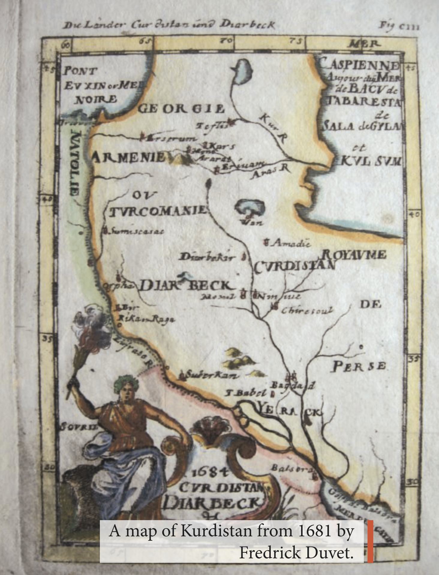
But the appearance of the name Kurdistan on maps as a Kurdish homeland or a region inhabited by Kurds dates to 1680 AD, meaning three hundred and thirty years ago, when the Dutch cartographer Frederick Duvet (1630-1706) published his map in which he drew the countries of the Ottomans, Iran, Armenia, Georgia, and other countries in the Middle East.
In this map, Kurdistan is shown in Latin in these forms: Churdistan, a rather strange spelling that was not widely circulated, as the name Kurdistan or Kurdestan and even Curdistan were common in the maps following Duvet’s one, for example in the maps of the famous English cartographer Emanuel Bowen (1714-1767), who was an official cartographer for King George II of Britain and King Louis XIV of France. Despite his great abilities and extensive efforts in drawing maps for these two royal figures, which would help them to occupy new countries, he died poor, and his son Thomas inherited poverty and a love of maps.
What attracts us about Bowen is that he drew a map of the Ottoman countries, including Kurdistan. It is quite striking that the borders of Kurdistan in this map differ from those drawn by his Dutch predecessor Duvet. In Bowen's 1680 map, we see that Kurdistan is an almost oval-shaped circle surrounding Lake Urmia on all sides, while in Duvet's map Kurdistan was shifted to the west and is a vast area extending from the western boundary of Lake Urmia to the border of the Tigris River, which separates it from the state of Diyarbakir and South of Lake Wan.
In 1711, the French cartographer Henri Chatelain also drew a map of Kurdistan with the word Curdistan, whose borders are almost the same as those drawn by Bowen. In the map drawn by the French mathematician and cartographer Rigobert Bonne of Fars Country in 1771, the features of Kurdistan appear clearer than those of its predecessors and includes Kirkuk, Mosul, and even the border of Hamadan in the east. Sixteen years later, Bonne drew another world map, this time showing the borders of Kurdistan reaching the confluence of the Tigris and Small Zab rivers.
Maps and borders
In my view, the geographical differences in the borders of Kurdistan are due to the different sources upon which these travelers and geographers (cartographers) relied. In addition to the ambiguity that encircled this name, was this area the only region in which the Kurds were located?
We note that none of the cartographers included Diyarbakir and the areas of present-day southern Iranian Kurdistan within the borders of Kurdistan maps, but these areas certainly encompassed tribes of Kurdish people settled there since ancient times. Furthermore, the states whose borders were drawn by those European cartographers did not have a national character. For example, they wrote the states of Diyarbakir, Jazira, or Erzurum without specifying the settlers’ nationalities.
We can also say that the information of those travelers was sometimes inaccurate, as they depended on geographical perception or imagination without actual travelling in and visiting the areas and exploring the area’s borders and the nationalities therein. For instance, one cartographer drew Yemen in the middle of the Arabian Peninsula on the borders of what is now known as Qatar and Bahrain.
Nevertheless, what ultimately concerns us is that these historical documents refute the nationalist-chauvinistic claims that there is no national homeland called Kurdistan. This historical fact deserves to be source material for academic and scientific research, and I hope that the officials of Kurdish institutes and universities, especially in the Kurdistan Region, give this sensitive issue their attention, as it is a scientific response to the allegations of those who deny the right of the Kurdish people to establish their desired state.
Jan Dost is a prolific Kurdish poet, writer and translator. He has published several novels and translated a number of literary Kurdish masterpieces into Arabic.