Loristan is a great region of Kurdistan and home to several long-serving Kurdish dynasties and independent states in history. Many medieval and early modern historians and geographers mention this great kingdom that, besides ruling Loristan independently, greatly contributed to the leadership of the Iranian ruling class. In fact, the Zand Dynasty, founded by Kerim Khan Zandi, a Lor belonging to the Zand branch ruled Iran from 1751 to 1794.[i] Kerim Khan was considered one of “the most enlightened rulers in Iranian history…”[ii] This was the first Indo-Iranian ruler of Iran since the invasion of the Arab Islamic forces and later the Turkic and Mongol nomads.[iii]
In April 1207, Ibn al-Athir (1160 -1233) called the people of Loristan “Lur Kurds[iv]” and described its geography as located between Fars, Khuzistan, and Isphan.[v] Yāqūt al-Hamawī (1179-1229) writes: “Mountains inhabited by the Kurds in the vicinity of Ispahan and Khuzistan. The name of this tribe extends to all these areas, which we often call Louristân or land of the Lours.[vi]” Persian historian and geographer Hamd Allah Mustawfi Qazvini (1281-1349) extensively details Loristan and other parts of Kurdistan and the historical changes in the names for the area and people across different periods.
North African-Moroccan traveler Ibn Battuta (1304-1369) traveled through Loristan and described its regions, cities, and people. His observations are particularly useful because they provide a much broader insight into the country.
The Kurdish king of Bitlis Şeref (Sharaf) Khan [king] (1543-1599), the author of the Kurdish dynasties, also provides a detailed description of the Kingdom of Loristan up to his day, while the Ottoman geographer Katib Çelebi (1609-1657) gives an extensive description of the origin and geography of the kingdom.
Meanwhile, Ottoman traveler Evliya Çelebi (1611-1682) visited Loristan and mentioned the King of Loristan among the kings of Kurdistan in the 1650s. He recounts how the Ottoman governor of Baghdad Murtezâ Paşa/Pasha (653-1654)[vii] sent a gift to King Sleyman of Loristan and other Kurdish kings while he was in the region.[viii]”
In general, most accounts agree that Loristan was initially divided into two parts: great and little Loristan.[ix] It was among the few kingdoms in the greater Middle East that survived the invasions of the Mongol and Turkic nomads from the 12th to 18th centuries.
Qazvini, Sharaf Khan, and Katib Çelebi agree on the origin and migration of the founders of the Loristan Dynasty. All three scholars identify the ruler and say that most citizens are from the West of Syria.[x]
The following map shows historical Syria and West of Syria.
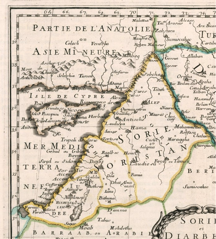
Sanson, N. (1652) Sorie et Diarbeck. Pub. in Paris
However, Qazvini and Şeref Kan describe the migration of Kurds in detail.
Qazvini states: “A. H. 500[i] (1107) some hundred families of Kurds emigrated from Jabalu's-Summaq (Sumac Mountain) into Loristan. Their chief was Abu'l-Hasan Fadluya, who had a son named Ali. He was wounded by his (P.134) enemies (538) but saved by his dog. Ali left a son named Muhammad ... He died leaving a son named Abu Tahir, who, by his courage, rose high in Sunqur's service, subdued Luristan, and became an independent sovereign. He died in A. H. 555 (1160) … Hazarasp succeeded his father and ruled well and justly, so that more tribes, such as the "Aqilis and Hashimis and some two dozen others whose names are enumerated migrated into the country from Jabalu's-Summaq (Sumac Mountain) and other places…, while Hazarasp extended his domain to within four parasangs (22.4 km) of Isfahan. The title of Atabek (King) was conferred by the Caliph[ii] an-Nasir on Hazarasp…” (Ḥamdallāh, 1330)[iii]
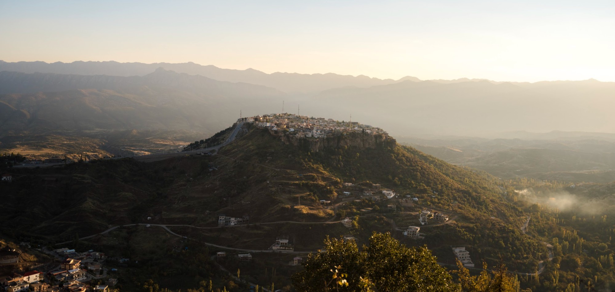
Sumac Mountain is located to the west of the city of Mersin in the Mersin province.[iv] The following map shows the original home of the majority of Kurdish-Lors and their capital in Loristan, “Mala-Mir” (Izeh, name changed in 1937 by the Iranian Government).
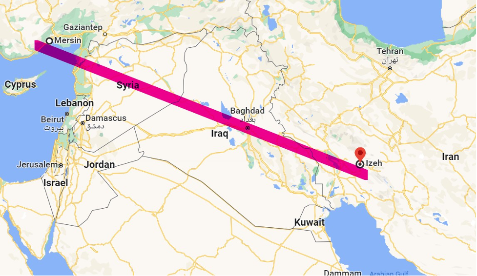
Mersin is considered among the cities of Kurdistan by the Ottoman geographer Kaib Çelebi.[1]
The Map of Kurdistan and Loristan from 1721 are both underlined with yellow by the author.

L’Isle, D. De (1721) Map of Turkey, Arabia, and Persia. Royal Society of London and Paris
Amed Demirhan MLIS., MADR is General Manager and Director of the Barzani National Memorial. He is a multilingual librarian and researcher internationally recognized with multiple awards in librarianship.
[1] Kâtip, C. (1609-1657)., Bayhan, N., Karlığa, B., Öztürk, S., & Koyunoğlu, H. (2010). Cihânnümâ. İstanbul: İstanbul Büyükşehir Kültür A.Ş. Yayınları, pp. 537-539. [i] Sharf Han use exact the same date 1107 or 500 Hijri of migration, p. 30. [ii] The titles of kings and emperors had to be conferred on rulers by the Caliph of Islam. In some respects, it was similar to how the Pope crowned the Kings and Emperors in Europe. For example, “… the pope crowned the king as emperor at a Christmas Mass (see A New Direction: The Pope Crowns Charlemagne Emperor).” Kidner, Frank L.. Making Europe: The Story of the West, Volume I to 1790, p. 259. Cengage Textbook. Kindle Edition. [iii] Hamd Allah Mustawfi Qazvini, fl. 1330-1340; Browne, Edward Granville, 1862-1926; Nicholson, Reynold Alleyne, 1868-1945. The Ta'ríkh-i-guzída; or, "Select history" of Hamdulláh Mustawfí-i-Qazwíní, compiled in A.H. 730 (A.D. 1330), and now reproduced in fac-simile from a manuscript dated A.H. 857 (A.D. 1453) Leyden : E.J. Brill; London, Luzac & Co., p. 135. [iv] Sumak Dağı Mersin şehrinde yer almaktadır. Sumak Dağı coğrafi konumu 36° 21′ 21″ Kuzey ile 33° 3′ 7″ Doğu gps koordinatlarıdır.