Geoscience deals with the processes that control the development of the Earth’s surface and distribute specific rock types at selected locations. It is the key to locating new reserves of natural resources and exploiting them in an optimal way.
At the same time, investment in research boosts innovation, advancement in science, and economic growth. As a leading example, U.S. expenditure on science was $656 billion in 2019, much of which came from the private sector. Such investment also yields a highly skilled technical labor force, the engine for growth in today’s economy.
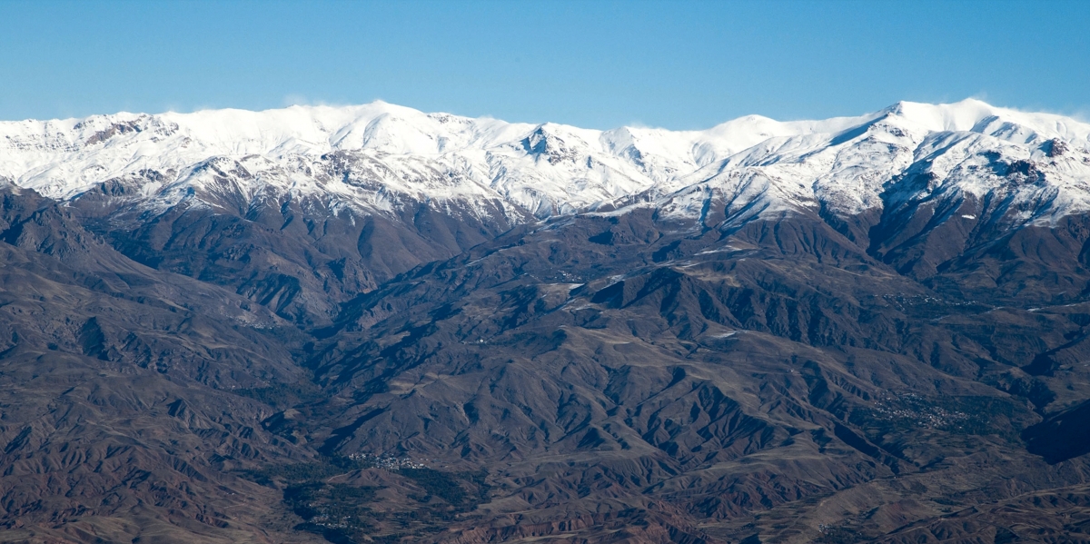
Despite more than 100 years of oil discoveries and nearly 20 years of hydrocarbon exploration, it is still challenging to demystify the geologic evolution of the Zagros Mountains of the Kurdistan region of Iraq. Yet this challenge provides opportunities for new discoveries and revisions of previous geologic interpretations.
As one plate goes beneath another one along the convergent margin, magmas and fluids are released from the downgoing plate. The ascending material interacts with its medium and makes its way to the surface as volcanoes. During this process, fluid-saturated melts may rest in the upper part of the crust (less than 10 km from the surface) and precipitate minerals during heat loss over time.
As the collision of two plates intensifies, rock layers deform, mountains form, and the earth’s crust thickens. Meanwhile, the erosion of mountain tops and deposition in the adjacent deflected lands form sedimentary basins.
The consensus regarding such convergent plate boundaries is that, even though they might be associated with natural hazards, they host a considerable amount of natural resources such as metals, minerals and hydrocarbons. However, to properly identify resources and mitigate the effects of natural hazards at convergent margins, understanding the timing and mechanisms of mountain formation is essential.
For instance, determining the timing of the engagement of the basement – the hard rock beneath sedimentary rocks – in the process of deformation helps to elucidate the timing of hydrocarbon migration and the spatial distribution of petroleum systems in terms of their construction and destruction. The inaccurate presumption of stacked, faulted sedimentary rocks via duplexing versus basement-cored deformation could lead to the misidentification of petroleum plays.
Constraining the timing of individual structures and the overall progression of the fold-thrust belt is also critical for evaluating petroleum-system processes, including assessing the relative timing of the formation of structural traps, as well as hydrocarbon generation and migration, to avoid drilling dry holes.
The Zagros Mountains are a prominent collisional orogen that stretches for roughly 2000 km across the Middle East, which formed over roughly 70 million years ago as a consequence of the Arabia-Eurasia convergence involving the subduction of the Neotethys oceanic plate beneath Eurasia and a subsequent collision of the Arabian and Eurasian continental plates.
This long period of deformation resulted in an amalgamation of different terrains between the Arabian and Eurasian plates. Since each tectonic accretion process overprinted the preceding configuration, reconstructing how the present-day Zagros Mountains were formed is daunting.
Geologically, the Kurdistan region of Iraq is the northwestern part of the Zagros belt, a strategic location where the Arabian and Eurasian tectonic plates met for the first time roughly 30 ± 5 million years ago. The area along the Iraq-Iran border is the suture of the two plates and includes rock masses that originally formed at 10s of kilometers deep and at various geologic settings within oceanic and along continental plates.
In recent years, researchers have shed new light on the geological development of the Zagros belt in the Kurdistan region by using cutting-edge technologies in geochronology and thermochronology to understand the order and style of events that shaped present-day geology. Fieldwork supported by laboratory analysis of rock samples also permitted the testing of new ideas.
After the development of a subduction zone within the Neotethys Ocean roughly 115 million years ago, piles of rocks from the Earth's lower crust and upper mantle were emplaced on the northeastern margin of the Arabian plate roughly 70 million years ago. Eroding sediments from the uplifted rocks shed on the newly formed land depression adjacent to the rocks as evidenced from the detrital zircon provenance data and detrital zircon (U-Th)/He ages.
Afterwards, for about 30 million years, magmatic activity escalated along the Eurasian plate margin. Remnants of these rocks are partially preserved in the Arabia-Eurasia suture zone. The fingerprint of this magmatic activity is also indicated by the detrital zircon U-Pb and (U-Th)/He data in the sedimentary rocks.
Starting between 26 and 36 million years ago, a significant reduction of magmatism was observed. Supported by evidence, this period represents the timing of the collision between the Arabian and Eurasian plates from the beginning to the complete suturing in the NW Zagros. After the collision, the Zagros collisional zone underwent uplift and erosion starting about 22 million years ago. Later, between 4 and 14 million years ago, a further enhanced uplift of mountains took place from the mountainous area toward the interior of the Arabian plate.
Fine tuning these events and revealing the details of each process, will help better understanding geological concepts and identifying potential areas for mineral accumulation in associated extinct magmatism. Field observation shows widespread igneous and metamorphic rocks in the suture of Arabia and Eurasia.
As an example, among other metallic minerals, existing preliminary investigations show indicators of copper (Cu) deposits occurrence, a much-needed mineral for future green technologies.
In short, the imperative to optimize the utilization of natural resources and secure new reserves for sustainable growth will render investing in geoscience scientific research necessary.
Dr. Renas Ismael Koshnaw is a postdoctoral researcher at Georg-August-University Göttingen, Germany.